

Collection: Story Collection
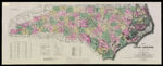
Name: Map of North Carolina by W.C. Kerr, assisted by Capt. Wm. Cain, C.E. Published Under the Authority of the State Board of Agriculture. 1882.
Barcode:
Image Number:
Creator:
Publishing Location:
Notes: Notes: "Published under the authority of the State Board of Agriculture." "Constructed from original surveys and triangulations of the U.S. Coast and Geodetic Survey of Prof. Guyot ... and embodying the surveys made by the state from 1820 to date, of swamp lands, rail roads, rivers, canals and turnpikes ..." "The Map of a large part of the Mountain region was plotted to scale from his own Triangulations, and furnished to hand, by Prof. A. Guyot, of Princeton." Dedicated to Governor Thomas J. Jarvis.
Date/Date Range Produced: 1882
Language:
Region Depicted:
Dimensions: 28 x 41
Physical Description: 1 map: colored, illustrated
LC Call Number: G3902 .K4 1882
OCLC: 25311245
Accession Number: ST-1882-12
Donor:
Permanent URL: