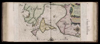
Caarte No. 26 || Chart number 26: Description of the shores of the sea of Courland and Livonia, with all the islands and gulfs between Memel (Neman) and Revel (Tallinn). (folded)
Collection: Osher Collection
Name: Caarte No. 26 || Chart number 26: Description of the shores of the sea of Courland and Livonia, with all the islands and gulfs between Memel (Neman) and Revel (Tallinn). (folded)