Showing 121-130 of 360 results

Sort By:

Index to topographic maps of New Hampshire and Vermont
Publisher:
Date/Date Range Produced: 1986
LC Call Number: G3741.A2 1986 .G4
OCLC: 18063145
Accession Number: OML-1986-121
Image Number:


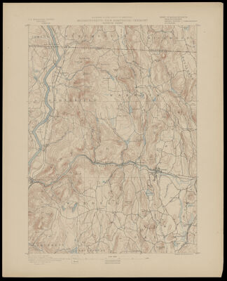
Geologic map index of New Hampshire and Vermont 
Publisher:
Date Produced: 1982
Language:
Dimensions: 24 x 21 cm, on sheets 29 x 45 cm, folded to 29 x 23 cm
LC Call Number: G3741.C5 1982.M2
OCLC: 9289610
Accession Number: OML-1982-127
Image Number:


North America. Vermont. Raft on Lake Champlain.
Creator:
Date Published: 1847
Publisher:
Language:
Dimensions: 17 x 11.5 cm
Image Number:


An Accurate Map of New Hampshire in New England, from a late Survey.
Creator:
Publisher:
Date/Date Range Produced: 1781
Language:
Region Depicted:
Map Type:
Dimensions: 32 x 28 cm. on sheet 38 x 33 x cm.
Printing Process:
Material Type:
OCLC: 869477710
Accession Number: OS-1781-2
Donor:
Subjects:
Image Number:


Index to topographic maps of New Hampshire and Vermont
Publisher:
Date/Date Range Produced: 1986
LC Call Number: G3741.A2 1986 .G4
OCLC: 18063145
Accession Number: OML-1986-121
Image Number:


Geography of New Hampshire. / New Hampshire and Vermont.
Date Published: 1886
Content:
Publisher:
Image Number:


Fodor's 2001 Maine, Vermont, New Hampshire
Publisher:
Date Produced: 2001
Language:
Physical Description: xxxv, 264 p. : maps (some col.) ; 23 cm
LC Call Number: F17.3 .F6 2001
OCLC: 45840023
Accession Number: AUL-2001-23
Donor:
Image Number:


Queen City Cotton Co.
Surveyor:
Date/Date Range Produced: Sep 27th, 1917
Region Depicted:
Donor:
Image Number: