Parts of Arkansas and Louisiana
↑ Parent: Atlas to accompany the Official Records of the Union and Confederate Armies published under the direction of the Hon. Stephen B. Elkins, Secretary of War Maj. George B. Davis U.S.A. Mr. Leslie J. Perry Mr. Joseph W. Kirkley Board of Publication Compiled by Capt. Colvin D. Cowles 23d. U.S. Infantry Part IX.
Collection:
Osher Collection
Name: Parts of Arkansas and Louisiana
Barcode: 3776
Image Number: 3776.0007
Creator: Davis, George B. (George Breckenridge), 1847-1914Trask, W. S.Venable, Richard M. (Richard Morton), 1839-1910
Date Created: 1864
Date Published: 1864
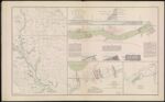
Alternative Title: Section including falls and dam in Red River; Sketch of the Battle-Field of Ocean Pond, Fla. February 20th, 1864; Part of Louisiana. Sketch of General Liddell's plan, January, 1864.
Notes: "February 20th"
"January" 1864 - Inscribed on Map
Permanent URL:
https://oshermaps.org/map/3776.0007