

Collection: Osher Collection
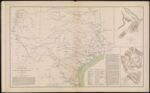
Name: Map of Texas and part of New Mexico
Barcode:
Image Number:
Creator:
Date Created:
Date Published:
Alternative Title: Plan of the Battle-Field at New Creek, W. Va. August 4th, 1864; Plan of the Battle-Field at Pleasant Mills near Cumberland, MD. August 1st, 1864
Notes: Extensive list of authorities present under title. "August 4th" "August 1st" 1857 - Inscribed on Map; 1864 - Inscribed on Map
Permanent URL: