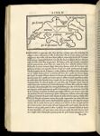
Marmora
↑ Parent: Libro di Benedetto Bordone. Nel qual si ragiona de tutte l'isole del mondo, con li lor nomi antichi & moderni, historie, fauole, & modi del loro uiuere, & in qual parte del mare stanno, & in qual parallelo & clima giacciono. Con il breve di papa Leone ...
Collection:
Osher Collection
Name: Marmora
Barcode: 7327
Image Number: 7327.0154
Creator: Bordon, Benedetto, 1450-1530
Date Created: 1528
Date Published: 1528
Printing Technique: Wood
Notes: [Marmara Sea]
Physical Description: Map title referenced from Karrow, 1993, "Mapmakers of the 16th century and their maps", pgs 89-93.
Permanent URL:
https://oshermaps.org/map/7327.0154