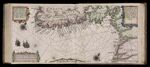
Caarte No. 30 || Chart Number30: Description of the sea coasts of Norway between Caoe der Neuse and the Pater Nostres, with all the sea ports located between the two, including the coast of Jutland from the Holmes up to the Skagen.
↑ Parent: Het Licht der Zee-vaert : daerinne claerlck beschreven ende afgebeeldet werden, alle de Custen ende Havenen, vande Westersche, Noordsche, Oostersche ende Middelandsche Zee'n. Oock van vele Landen, Eylanden ende plaetsen van Guinea, Brasilien, Oost ende West-Indien Ut de alderbeste Zeebeschryvers gheschriften (als Lucas Iansz. wage-naer ende meer andere) eensdeels vergadert: maer uyt vele ervarene Zeevaerders schriften ende mondtlcke verclaringhen van alle verlopen ghebetert, ende met nieuwe beschrvinghen ende Caerten seer vermeerdert ... Door Willem Ianz Zoon
Collection:
Osher Collection
Name: Caarte No. 30 || Chart Number30: Description of the sea coasts of Norway between Caoe der Neuse and the Pater Nostres, with all the sea ports located between the two, including the coast of Jutland from the Holmes up to the Skagen.
Barcode: 7356
Image Number: 7356.0222
Creator: Blaeu, Willem Janszoon, 1571-1638
Date Created: 1608
Date Published: 1608
Language: Dutch
Region Depicted: Norway
Subjects: Norway
Permanent URL:
https://oshermaps.org/map/7356.0222