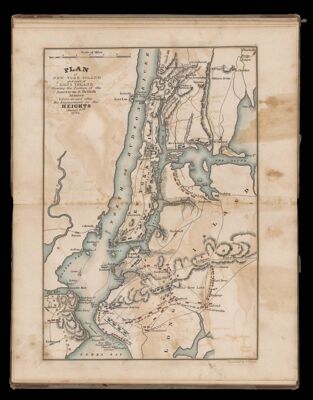
Plan of New York Island and part of Long Island shewing the position of the Ameriocan & British armies before, at, and after the engagement on the heights August 27th, 1776
Collection: Smith Collection
Name: Plan of New York Island and part of Long Island shewing the position of the Ameriocan & British armies before, at, and after the engagement on the heights August 27th, 1776
Barcode: 4599
Content: Map
Subjects: American Revolution, 1775-1783
Region Depicted: Hudson RiverLong Island, New YorkLong Island, New YorkNew York Harbor
Dimensions: 29 x 22.2 cm
Permenant URL: https://oshermaps.org/map/4599.0012