

Collection: Smith Collection
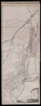
Name: A Chorographical map of the Country between Albany, Oswego, Fort Frontenac, and Les Tris Rivieres : Exhibiting all the Grants made by the French Governors on Lake Champlain; & between that Lake & Montreal. / The Provinces of New York, and New Jersey; with part of Pensilvania, and the Governments of Trois Rivieres, and Montreal.
Barcode:
Image Number:
Creator:
Date Published: Jun 15th, 1775
Content:
Full Title: A Chorographical map of the Country between Albany, Oswego, Fort Frontenac, and Les Tris Rivieres : Exhibiting all the Grants made by the French Governors on Lake Champlain; & between that Lake & Montreal. / The Provinces of New York, and New Jersey; with part of Pensilvania, and the Governments of Trois Rivieres, and Montreal.
Publisher:
Language:
Region Depicted:
Dimensions: Map: H 135 x W 52 cm on sheet: H 139 x W 55 cm
Printing Process:
Printing Technique:
Permanent URL: