

↑ Parent: Atlas Accompanying Greenleaf's Map and Statistical Survey of Maine.
Collection: Osher Map Library Collection
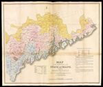
Name: Map of the inhabited part of the State of Maine, exhibiting the progress of its settlement since the 1778, The representative districts since the year 1820, and the population and valuation of taxable property in each district at the year 1820.
Barcode:
Image Number:
Creator:
Date Created:
Date Published:
Alternative Title: Plate VI.
Notes: 1828 - Inscribed on Map; 1820 - Inscribed on Map; 1778 - Inscribed on Map; 1829 - Copyright
Permanent URL: