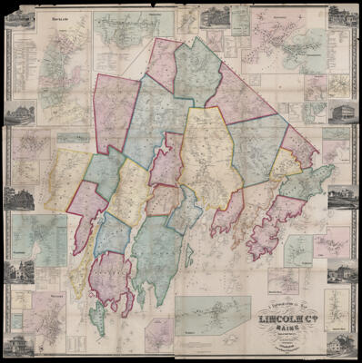
A Topographical Map of Lincoln Co. Maine from actual Surveys by C.M. Hopkins Publishers Lee & Marsh
Collection: Osher Map Library Collection
Name: A Topographical Map of Lincoln Co. Maine from actual Surveys by C.M. Hopkins Publishers Lee & Marsh
Barcode: 13248
Creator: Hopkins, C. M.Lee & Marsh
Publishing Location: Philadelphia
Notes: Contains several inset maps: "South Thomaston," "Warren," "Bristol Mills," "Washington," "Union," "Owls Head," "North Jefferson," "Tennants Harbor," "Shepscot Bridge" "Round Pond," "New Castle, Damariscota," "Bay Village," "Boothbay Harbour," "Thomaston," "South Union," "Waldboro," "Wiscasset," "East Union," "North Union," "Dresden," "Damariscotta," "Whitefield," "Bay Village," "New Castle"
Date/Date Range Produced: 1857
Date/Date Range Published: 1857
Language: English
Map Type: Wall maps
Dimensions:
LC Call Number:
OCLC:
Subjects: Lincoln County, MaineMaine
Permenant URL: https://oshermaps.org/map/13248.0001