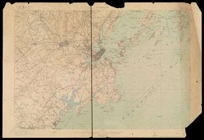
Maine, Portland and vicinity
Collection: Osher Map Library Collection
Name: Maine, Portland and vicinity
Barcode: 46346
Creator: United States. Department of the Interior
From Atlas: No
Publishing Location: Washington D.C.
Notes: On verso: The topographic maps of the United States / by The Director, United States Geological Survey, Washington, D.C., June, 1916. -- 3 columns : ill.
Publisher: Geological Survey (U.S.)
Date/Date Range Produced: 1916
Date/Date Range Published: 1916
Language: English
Region Depicted: Buxton, MaineCape Elizabeth, MaineCasco Bay, MaineCumberland, MaineFalmouth, MaineGorham, MaineHarpswell, MaineOld Orchard Beach, MainePortland, MaineSaco Bay, MaineSaco, MaineScarborough, MaineSouth Portland, MaineWestbrook, MaineWindham, Maine
Map Type: Wall maps
Dimensions:
LC Call Number:
OCLC: 11957163
Donor: Ball State University
Subjects: Casco Bay Region (Me.)--MapsGeological Survey (U.S.)Portland (Me.) --HistoryRailroadsTopographic mapsU.S. Coast and Geodetic SurveyUnited States. Department of the Interior
Permenant URL: https://oshermaps.org/map/46346.0001; 46346.0002