Tunison's new map of the missionary journeys of St. Paul
Collection: Osher Map Library Collection
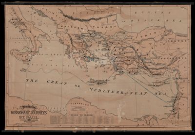
Name: Tunison's new map of the missionary journeys of St. Paul
Barcode: 53175
Creator: Tunison, Henry Cuthbert, 1855-
From Atlas: No
Publishing Location: Chicago
Notes: With index to placesShows the routes taken by St. Paul on his first, second and third missionary journeys and his voyage to Rome
Publisher: Tunison, Henry Cuthbert, 1855-
Date/Date Range Produced: 1902
Date/Date Range Published: 1902
Language: English
Region Depicted: GreeceIsraelItalyMediterranean regionPalestineTurkey
Map Type: Historical mapsWall maps
Dimensions: 110 x 160 cm
LC Call Number:
OCLC:
Subjects: Bible--GeographyPaul, the Apostle, Saint
Permenant URL: https://oshermaps.org/map/53175.0001