Sinclair pictorial map of New York City and the World's Fair : souvenir
Collection: Osher Map Library Collection
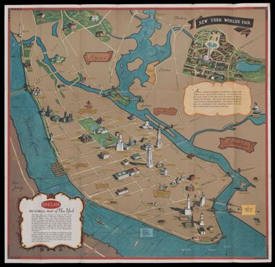
Name: Sinclair pictorial map of New York City and the World's Fair : souvenir
Barcode: 53202
Creator: Rand McNally and Company
Notes: Selected buildings shown pictorially in Manhattan, the southern Bronx, and at the World's Fair site in Queens.On verso: Indexed map [ca. 1:107,712]: Sinclair New York metropolitan area road map, "Sinclair New York World's Fair 1939 : general plan"
Publisher: Sinclair Refining Company
Date/Date Range Produced: 1939
Date/Date Range Published: 1939
Language: English
Region Depicted: New York
Map Type: Pictorial maps
Dimensions: 68 x 70 cm
LC Call Number: G3804.N4:2N39 1939.S5
OCLC: 27440854
Permenant URL: https://oshermaps.org/map/53202.0001; 53202.0002