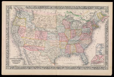
Map of the United States and Territories together with Canada &c.
Collection: Smith Collection
Name: Map of the United States and Territories together with Canada &c.
Barcode: 2242
Publishing Location: Philadelphia
Notes: Inset maps of Hampton Roads and Norfolk Harbor, and Pensacola Bay.Features decorative floral border.Note: "Entered according to Act of Congress in the year 1860 by S. Augustus Mitchell Jr. in the Clerks Office of the District Court of the U.S. for the Eastern District of Pennsylvania"
Date/Date Range Produced: 1860
Date/Date Range Published: 1860
Language: English
Region Depicted: United States
Dimensions: H 39 x W 58 cm
LC Call Number: G3700 .M5 1860
OCLC: 180138750
Donor: Smith
Permenant URL: https://oshermaps.org/map/2242.0001