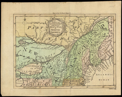
A New and Accurate Map of the present Seat of War in North America.
Collection: Osher Collection
Name: A New and Accurate Map of the present Seat of War in North America.
Barcode: 720
From Atlas: No
Notes: From Royal Magazine, vol. 1, October 1759, p. 183. Note above top neat line: "Engraved for the Royal Magazine". Note in lower right corner: "G. Rollos sculp."
Printmaker: Rollos, G., active 1754-1789
Publisher: Royal Magazine
Date/Date Range Produced: 1759
Date/Date Range Published: 1759
Language: English
Region Depicted: CanadaConnecticutMaineMassachusettsNew EnglandNew HampshireNew York (State)OntarioPennsylvaniaRhode IslandVermont
Map Type: GeographicalPolitical maps
Dimensions: H 20.3 x W 25.8 cm
Printing Process: Engraving
Printing Technique: Copper
Material Type: Paper
LC Call Number:
OCLC: 80617971
Donor: Osher
Permenant URL: https://oshermaps.org/map/720.0001