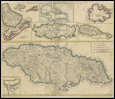
A new map of the English empire in the ocean of America or West Indies
Collection: Smith Collection
Name: A new map of the English empire in the ocean of America or West Indies
Barcode: 1839
Creator: Harris, John, active 1685-1720Senex, John 1678-1740
Publishing Location: London
Notes: From: "A New General Atlas containing a Geographical and Historical account of all Empires, Kingdoms, and other Dominions of the World" Note: "Sculpsit I. Harris" " Most humbly Inscrib'd to the Right Hon.ble Thomas, Earl of Stamford & c."
Date/Date Range Produced: 1721
Date/Date Range Published: 1721
Language: English
Region Depicted: AntiguaBahamasBarbadosBermuda IslandsCaribbean regionCaribbean SeaCubaGulf of MexicoHondurasJamaicaTrinidad and TobagoWest Indies
Dimensions: 50.5 x 59 cm
Printing Process: Engraving
Printing Technique: Copper
Material Type: Paper
LC Call Number: G4902 .S4 1721
OCLC: 230403440
Donor: Smith
Permenant URL: https://oshermaps.org/map/1839.0001