Collection: Smith Collection
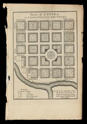
Name: Plan of Lystra, in Nelson County, Kentucky
Barcode:
Creator:
Notes:
Date/Date Range Produced:
Date/Date Range Published:
Language:
Region Depicted:
Dimensions: H 21.3 x W 14 cm
LC Call Number:
OCLC:
Donor:
Permenant URL: