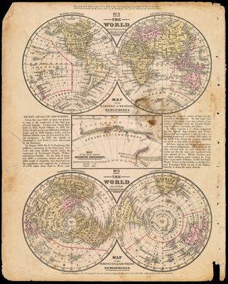
The World on an Equatorial Projection : Map of the Eastern & Western Hemispheres / The World on a Polar Projection : Map of the Northern & Southern Hemispheres.
Collection: Story Collection
Name: The World on an Equatorial Projection : Map of the Eastern & Western Hemispheres / The World on a Polar Projection : Map of the Northern & Southern Hemispheres.
Barcode: 12653
Notes: Note: "Entered according to Act of Congress in the year 1839, by S. Augustus Mitchell in the Clerk's Office of the District Court of Connecticut."Above The World on an Equatorial Projection: "No. 1"Above The World on a Polar Projection: "No. 2"Shares folder with ST-1839-9 through ST-1839-18
Publisher: Mitchell, S. Augustus (Samuel Augustus), 1792-1868
Date/Date Range Produced: 1839
Language: English
Region Depicted: World
Dimensions: 30 X 24 cm
Printing Process: Engraving
Printing Technique: Copper Letterpress
Material Type: Paper
LC Call Number:
OCLC:
Donor: Story
Permenant URL: https://oshermaps.org/map/12653.0001