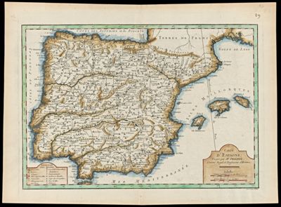
Carte d'Espagne Dirigee par M. Philippe, Censeur Royal et Professeur d'Histoire
Collection: Engass Collection
Name: Carte d'Espagne Dirigee par M. Philippe, Censeur Royal et Professeur d'Histoire
Barcode: 99
Creator: Philippe de Prétot, Étienne-André, 1710-1787Vallet, Jean-Emmanuel Jérôme, 1716-
Publishing Location: Paris
Notes: Map of Spain.Note lower right: "Gravé par Vallet"Includes a descriptive key of the symbols on the map
Date/Date Range Produced: 1787
Date/Date Range Published: 1787
Language: French
Region Depicted: Iberian PeninsulaPortugalSpain
Map Type: GeographicalHistorical maps
Dimensions: 27 x 38 cm
Printing Process: Engraving
Printing Technique: Copper
Material Type: Paper
LC Call Number: G6560 .P4 1787
OCLC: 71275769
Donor: Enggass
Permenant URL: https://oshermaps.org/map/99.0001