[Plate XLVI] Map of Illinois Constructed from Surveys in the General Land Office and other Documents By John Melish [1942 copy of 1819 original]

Collection: Osher Map Library Collection

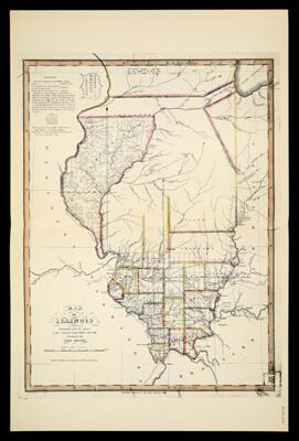
Name: [Plate XLVI] Map of Illinois Constructed from Surveys in the General Land Office and other Documents By John Melish [1942 copy of 1819 original]

Barcode: 14437

Creator: Melish, John, 1771-1822Tucker, Sara Jones

Date Created: 1819

Date Published: 1819

Notes: 1819 - inscribed on map

Permenant URL: https://oshermaps.org/map/14437.0043