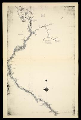
[Plate XXXIIA] A sketch of the Mississippi from the town of St. Louis to its source in the Upper Red Ceder Lake, exhibiting the communications with Lake Superior and the lower Red River, a branch of the Ossiboine River, of lake Winepic and marking the points at which the waters of the Mississippi, the St. Lawrence and Hudson's Bay, are separated. Taken from the notes of Lieutenant Zebulon Montgomery Pike of the 1st Regt. of Infantry, on a Tour of discovery made by him, pending the years 1805 and 1806, at the head of a Sergeant, Corporal and eighteen men. By Anthony Nau Sworn Interpreter of the French Language. Territory of Louisiana. [1942 copy of 1806-1810 original]
Collection: Osher Map Library Collection
Name: [Plate XXXIIA] A sketch of the Mississippi from the town of St. Louis to its source in the Upper Red Ceder Lake, exhibiting the communications with Lake Superior and the lower Red River, a branch of the Ossiboine River, of lake Winepic and marking the points at which the waters of the Mississippi, the St. Lawrence and Hudson's Bay, are separated. Taken from the notes of Lieutenant Zebulon Montgomery Pike of the 1st Regt. of Infantry, on a Tour of discovery made by him, pending the years 1805 and 1806, at the head of a Sergeant, Corporal and eighteen men. By Anthony Nau Sworn Interpreter of the French Language. Territory of Louisiana. [1942 copy of 1806-1810 original]
Barcode: 14437
Creator: Nau, AnthonyPike, Zebulon Montgomery, 1779-1813Tucker, Sara Jones
Date Created: 1806 - 1810
Date Published: 1806 - 1810
Permenant URL: https://oshermaps.org/map/14437.0032