Collection: Osher Map Library Collection
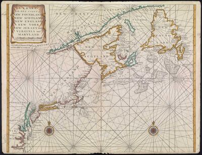
Name: Chart of the Sea Coast of New Foundland, New Scotland, New England, New York, New Jersey, with Virginia and Maryland.
Barcode:
Creator:
Date/Date Range Produced: 1748 - 1770
Language:
Dimensions: 38 cm. x 64 cm. on sheet 54 cm. x 70 cm.
Printing Process:
Printing Technique:
Material Type:
Notes:
LC Call Number: G3320 1770 .T4
OCLC: 48768734
Accession Number: OML-1770-9
Permenant URL: