Collection: Osher Map Library Collection
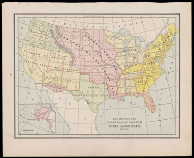
Name: Map showing the Territorial Growth of the United States 1776-1887
Barcode:
Creator:
Notes:
Date/Date Range Produced:
Date/Date Range Published:
Language:
Region Depicted:
Dimensions: Map: H 22.5 x W 30 cm on sheet: H 28 x W 34.5 cm
LC Call Number:
OCLC:
Permenant URL: