Collection: Osher Map Library Collection
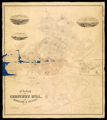
Name: Plan of Chestnut Hill in Brookline and Newton
Barcode:
Creator:
Date/Date Range Produced:
Date/Date Range Published:
Dimensions: 31 x 24
LC Call Number: G3764.B6 1856 S5
OCLC: 843955937
Accession Number: OML-1856-39
Donor:
Permenant URL: