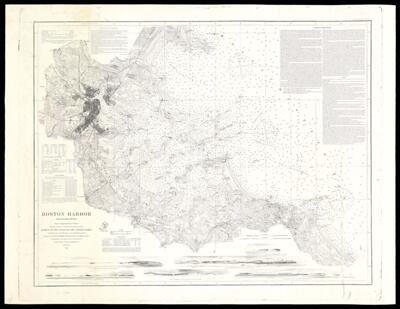
Boston Harbor Massachusetts Survey of the Coast of the United States
Collection: Osher Map Library Collection
Name: Boston Harbor Massachusetts Survey of the Coast of the United States
Barcode: 12495
Creator: Bache, A. D. (Alexander Dallas), 1806-1867
Publishing Location: Washington D.C.
Notes: Covers Boston Bay and adjacent water and land areas.
Information on Sailing Directions in upper right corner of map.
"From a Trigonometrical Survey under the direction of A.D. Bache Superintendent of the Survey of the Coast of the United States"
Includes text, tables of sailing information, and 6 coastal panoramas.
Above neat line: "No. 337"
Date/Date Range Produced: 1867
Date/Date Range Published: 1867
Language: English
Dimensions: 68 x 89
LC Call Number: G3762.B65P5 1867 .U5
OCLC: 31904270
Accession Number: OML-1867-18
Donor: Pratt
Permenant URL: https://oshermaps.org/map/12495.0001