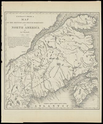
Extract from a Map of the British and French Dominions in North America
Collection: Osher Map Library Collection
Name: Extract from a Map of the British and French Dominions in North America
Barcode: 12938
Creator: Mitchell, John, 1711-1768
Printmaker: Stone, William James, 1798-1865
From Atlas: No
Publishing Location: New York
Notes: Note: "This map was undertaken with the approbation and at the request of the Lords Commissioners for Trade and Plantations; and is chiefly composed from draughts, charts and actual surveys of different parts of His Majesties colonies and plantations in America; great part of which have been lately taken by their Lordships Orders and transmitted to this office by the governors of the said colonies and others." John Pownall, Secretary
Date/Date Range Produced: 1840
Date/Date Range Published: 1840
Language: English
Region Depicted: CanadaMaineNew EnglandNova Scotia
Map Type: GeographicalPolitical maps
Dimensions:
Printing Process: Engraving
Printing Technique: Steel
Material Type: Paper
LC Call Number:
OCLC: 900987221
Donor: Shain
Subjects: CanadaMaineMitchell, John, 1711-1768New EnglandNova Scotia (Canada)
Permenant URL: https://oshermaps.org/map/12938.0001