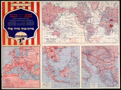
Richfield news map of Europe
Collection: Osher Map Library Collection
Name: Richfield news map of Europe
Barcode: 41836
Notes: "Edited as of August 6, 1941" Inset maps for "Northern Scandinavia" and "Southern England and Adjacent Continental Areas"; verso contains 4 maps: "Europe Mileage Distance," "The World," "The Balkans," and "The Far East"
Date/Date Range Produced: 1941
Date/Date Range Published: 1941
Language: English
Region Depicted: Europe
Map Type: Military mapsPolitical maps
Dimensions: 53 x 71 cm
LC Call Number:
OCLC:
Subjects: World War, 1939-1945
Permenant URL: https://oshermaps.org/map/41836.0001; 41836.0002