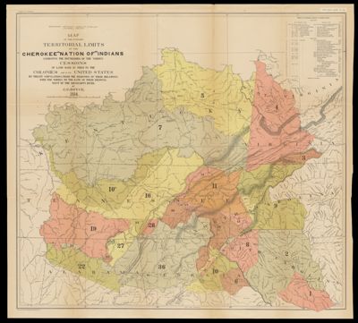
Map of the Former Territorial Limits of the Cherokee "Nation of" Indians exhibiting the boundaries of the various Cessions of Land made by them to the Colonies and to the United States by treaty stipulations, from the beginning of their relations with the whites to the date of their removal west of the Mississippi River. by C. C. Royce, 1884
Collection: Osher Map Library Collection
Name: Map of the Former Territorial Limits of the Cherokee "Nation of" Indians exhibiting the boundaries of the various Cessions of Land made by them to the Colonies and to the United States by treaty stipulations, from the beginning of their relations with the whites to the date of their removal west of the Mississippi River. by C. C. Royce, 1884
Barcode: 36149
Creator: Royce, Charles C., 1845-1923
Publishing Location: Washington D.C.
Notes: Shows parts of present states of: Kentucky, Tennessee, Alabama, Georgia, South Carolina, North Carolina, Virginia and West Virginia. Note: "N. Peters. Photo-Lithographer, Washington, D.C." Includes numeric and chronologic schedule of Cherokee cessions.
Publisher: Smithsonian Institution. Bureau of American Ethnology
Date/Date Range Published: 1884
Language: English
Region Depicted: AlabamaGeorgiaKentuckyNorth CarolinaSouth CarolinaTennesseeVirginiaWest Virginia
Dimensions: Map: 70 x 78 cm on sheet: 76 x 84 cm
Printing Process: Lithograph
Material Type: Paper
LC Call Number: G3861.E1 1884 .R6
OCLC: 20905374
See Also: Map Showing the Territory Originally Assigned to the Cherokee "Nation of" Indians West of the Mississippi, also the boundaries of the Territory now Occupied or Owned by them, by C. C. Royce, 1884
Subjects: Indigenous peoplesNative American tribesSettler-colonialism
Permenant URL: https://oshermaps.org/map/36149.0001