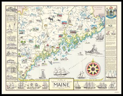
Map of Western, Central, and Eastern Maine
Collection: Osher Map Library Collection
Name: Map of Western, Central, and Eastern Maine
Barcode: 36608
Creator: Lepper, Ruth Rhoads
Publishing Location: West Southport, ME
Notes: Includes historical notations and line drawings of ships and historical buildings in Maine.
Publisher: Spaulding-Moss Company
Date/Date Range Published: 1952
Language: English
Region Depicted: Maine
Map Type: Pictorial maps
Dimensions: Map: 35.5 x 41 cm on sheet 43 x 56 cm
Printing Process: Offset lithograph
Material Type: Paper
LC Call Number:
OCLC: 181101087
See Also: Map of the Maine Coast from Rockland, thru Schoodic, to CoreaThe Maine Coast, A Map of Casco Bay
Subjects: Maine historyShips
Permenant URL: https://oshermaps.org/map/36608.0001