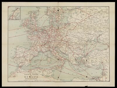
Map of Cook's tours in Europe
Collection: Osher Map Library Collection
Name: Map of Cook's tours in Europe
Barcode: 50743
Publisher: Thomas Cook (Firm)
Date/Date Range Produced: 1896
Region Depicted: EnglandEuropeIrelandScotland
Dimensions: 33 x 44 cm
Notes: On verso: Map of Cook's tours in Ireland; Map of Cook's tours in Scotland & England.
Shows railroads, "Routes over which Cook's tickets are available," and "Steamer Routes."
OCLC: 971510580
Accession Number: OML-1896-71
See Also: Map of Cook's Tours in Central Europe.
Permenant URL: https://oshermaps.org/map/50743.0001; 50743.0002