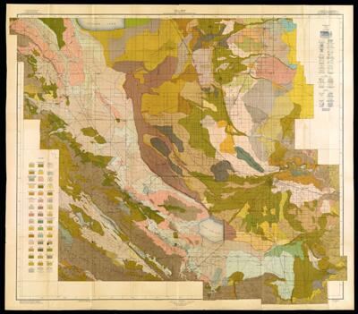
Soil Map California: Reconnoissance Survey, Upper San Joaquin Valley Sheet
Collection: Osher Map Library Collection
Name: Soil Map California: Reconnoissance Survey, Upper San Joaquin Valley Sheet
Barcode: 14330
Creator: United States. Bureau of Soils
Publishing Location: Washington D.C.
Notes: Topographic map. Shows waterways, roads, railroads, cities, and towns. Note below neat line: "Soils surveyed by J.W. Nelson, in charge, and Walter C. Dean, of the University of California, and E.C. Eckmann of the U.S. Department of Agriculture."" Stored in Soil Map collection on 3rd floor; very fragile
Date/Date Range Produced: 1917
Date/Date Range Published: 1917
Language: English
Dimensions: 97 x 114
LC Call Number: G4362 .S22 1917
Accession Number: OML-1917-34
Permenant URL: https://oshermaps.org/map/14330.0001