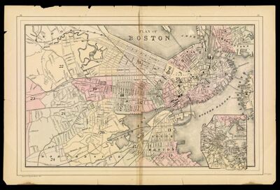
Plan of Boston
Collection: Osher Map Library Collection
Name: Plan of Boston
Barcode: 36578
Publisher: Mitchell, S. Augustus, Jr. (Samuel Augustus)
Publishing Location: No Location
Notes: Inset: "Map of the Country around Boston showing also its Harbor & Islands."
Note: "26" in top left corner; "27" in top right corner
Wards are numbered; some colored.
Date/Date Range Produced: 1884
Date/Date Range Published: 1884
Language: English
Region Depicted: Boston, Massachusetts
Dimensions: 32 x 49
LC Call Number: G3764.B6 1884 .M57x
OCLC: 747246553
Accession Number: OML-1884-27
Permenant URL: https://oshermaps.org/map/36578.0001