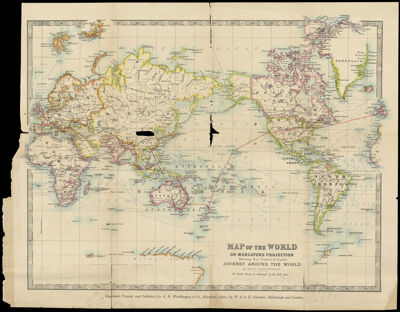
Map of the World on Mercator's Projection Showing Reverend Francis E. Clark's Journey around the World
Collection: Osher Map Library Collection
Name: Map of the World on Mercator's Projection Showing Reverend Francis E. Clark's Journey around the World
Barcode: 36597
Creator: Johnston, Alexander Keith, 1804-1871
Publishing Location: London & Edinburgh
Notes: Notes: "Dr. Clark's route is indicated by the red lines." "Engraved, printed, and published for A.D. Worthington & Co., Hartford, Conn., by W. & A.K. Johnston, Edinburgh and London."
Inset maps: Insets: "Map of Africa." "Northern Scandinavia."
Date/Date Range Produced: 1895
Date/Date Range Published: 1895
Language: English
Region Depicted: World
Dimensions: 33 x 43
OCLC: 880676270
Accession Number: OML-1895-43
Permenant URL: https://oshermaps.org/map/36597.0001