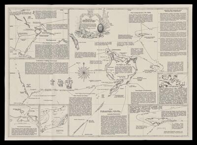
The True or verdadera route of Christopher Columbus October 12-27, 1492 : showing islands he discovered and his anchorages in the Bahamas Archipelago as reconstructed from his journal and other original sources
Collection: Osher Map Library Collection
Name: The True or verdadera route of Christopher Columbus October 12-27, 1492 : showing islands he discovered and his anchorages in the Bahamas Archipelago as reconstructed from his journal and other original sources
Barcode: 52481
Publisher: Larimore, Christopher C.
Date/Date Range Produced: 1992
Date/Date Range Published: 1992
Notes: Maps depict a Samana Cay landfall scenerio as favored by Christopher Larimore. Map likely created and presented in "Encounter '92," the newsletter of the quincentennial of Columbus's landfall in the Bahamas
OCLC: 810288775
Accession Number: OML-1992-99
Donor: Torodash
Permenant URL: https://oshermaps.org/map/52481.0001