Collection: Osher Map Library Collection
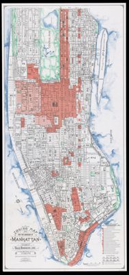
Name: Zoning map for the Borough of Manhattan
Barcode:
Notes:
Publisher:
Date/Date Range Produced:
Date/Date Range Published:
Language:
Region Depicted:
Map Type:
Dimensions: 141 x 65 cm
LC Call Number:
OCLC: 957674736
Permenant URL: