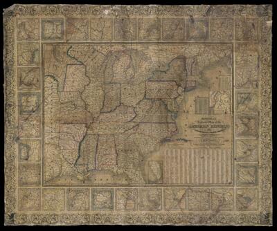
Mitchell's national map of the American Republic or United States of North America. Together with maps of the vicinities of thirty-two of the principal cities and towns in the Union.
Collection: Osher Map Library Collection
Name: Mitchell's national map of the American Republic or United States of North America. Together with maps of the vicinities of thirty-two of the principal cities and towns in the Union.
Barcode: 48974
Creator: Young, J. H. (James Hamilton)
Printmaker: Brightly, Joseph H., 1818-1901
Publisher: Mitchell, S. Augustus (Samuel Augustus), 1792-1868
Publishing Location: Philadelphia
Notes: Insets of 32 cities and towns surround map
Insets: "Map of the North-Eastern Boundary of the United States According to the Treaty of 1842"--"Map of the Southern part of Florida."
Date/Date Range Produced: 1845
Date/Date Range Published: 1845
Language: English
Dimensions: 85 x 107
LC Call Number: G3700 1845 .Y6 c.3
OCLC: 70793881
Accession Number: OML-1845-37
Permenant URL: https://oshermaps.org/map/48974.0001