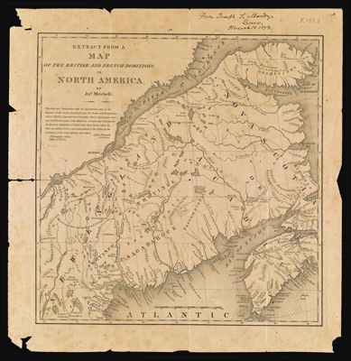
Extract from a Map of the British and French Dominions in North America
Collection: Osher Map Library Collection
Name: Extract from a Map of the British and French Dominions in North America
Barcode: 47995
Creator: Array
Printmaker: Stone, William James, 1798-1865
From Atlas: No
Publishing Location: New York
Notes: Handwritten note at top of map: "From Joseph L. Moody, Saco, March 18 1873." Note: "This map was undertaken with the approbation and at the request of the Lords Commissioners for Trade and Plantations; and is chiefly composed from draughts, charts and actual surveys of different parts of His Majesties colonies and plantations in America; great part of which have been lately taken by their Lordships Orders and transmitted to this office by the governors of the said colonies and others." John Pownall, Secretary.
Date is not 1755 by more likely 1838-40 (given the engraver).
Date/Date Range Produced: 1838 - 1840
Date/Date Range Published: 1755
Language: English
Region Depicted: CanadaMaineNew EnglandNova Scotia
Map Type: GeographicalPolitical maps
Dimensions: 34 x 33 cm on sheet 40 x 39 cm
Material Type: Paper
LC Call Number:
OCLC: 900987221
Subjects: CanadaMaineMaps--Early works to 1800Mitchell, John, 1711-1768New EnglandNova Scotia (Canada)Pownall, John, 1720-1795
Permenant URL: https://oshermaps.org/map/47995.0001