Collection: Osher Map Library Collection
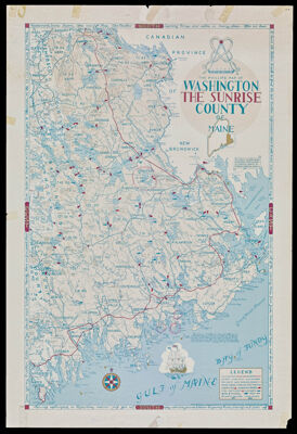
Name: The Phillips Map of Washington The Sunrise County of Maine
Barcode:
Creator:
From Atlas:
Publishing Location:
Notes:
Publisher:
Date/Date Range Produced:
Date/Date Range Published:
Language:
Region Depicted:
Dimensions: 71 x 46 cm on sheet 78 x 53 cm
LC Call Number: G3733.W4 P4 1969
Accession Number: OML-1969-106
Subjects:
Permenant URL: