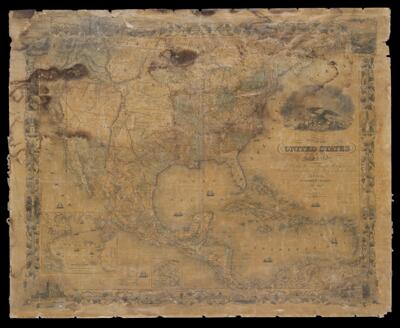
Map of the United States of America, the British provinces, Mexico, the West Indies and Central America, with part of New Granada and Venezuela
Collection: Osher Map Library Collection
Name: Map of the United States of America, the British provinces, Mexico, the West Indies and Central America, with part of New Granada and Venezuela
Barcode: 49499
Creator: Atwood, John M.Colton, G. Woolworth (George Woolworth), 1827-1901
Date/Date Range Produced: 1853
Date/Date Range Published: 1853
Notes: Insets: A map of the Atlantic Ocean showing the American & European ports and the routes of the ocean steamers; and: The Isthmus of Panama. Wall map, its original rods have been removed.
LC Call Number: G3300 1853 .C6
OCLC: 28167198
Accession Number: OML-1853-38
Permenant URL: https://oshermaps.org/map/49499.0001