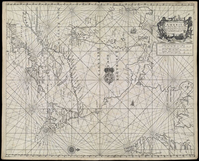
A Chart of ye North part of America. For Hudsons Bay Comonly called ye North West Passage. By John Thornton Hidrographer at the Platt in the Minories
Collection: Osher Collection
Name: A Chart of ye North part of America. For Hudsons Bay Comonly called ye North West Passage. By John Thornton Hidrographer at the Platt in the Minories
Barcode: 521
Creator: Thornton, John, 1641-1708
From Atlas: Yes
Notes: From: The English Pilot, Fourth Book (1689)
Atlas Reference: The English Pilot, Fourth Book, 1689
Subjects: Array
Publisher: Thornton, John, 1641-1708
Date/Date Range Produced: 1689
Date/Date Range Published: 1689
Language: English
Region Depicted: ConnecticutEastern CanadaGreenlandHudson BayMaineMaritime ProvincesMassachusettsNew EnglandNew HampshireNew York (State)Newfoundland and LabradorNova ScotiaOntarioRhode IslandVermont
Map Type: Nautical charts
Dimensions: H 44 x W 54.7 cm
Printing Process: Engraving
Printing Technique: Copper
Material Type: Paper
LC Call Number:
OCLC: 61637626
Donor: Osher
Permenant URL: https://oshermaps.org/map/521.0001