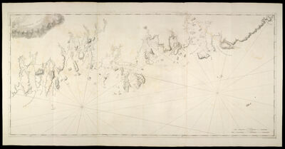
Coast of Maine-Moose Harbor to Watering Cove, including Mechiass Bay, Naragnagus Bay, and Gouldsborough, Dated April 24, 1776
Collection: Osher Collection
Name: Coast of Maine-Moose Harbor to Watering Cove, including Mechiass Bay, Naragnagus Bay, and Gouldsborough, Dated April 24, 1776
Barcode: 804
Creator: Anonymous / Unknown Author
From Atlas: No
Notes: Note: " "Publish'd According to Act April 24,, 1776, by J.F.W. Des Barres Esqr." Title supplied by cataloger, no title on map itself.
Publisher: Des Barres, Joseph F. W. (Joseph Frederick Wallet), 1729-1824
Date/Date Range Produced: 1777
Date/Date Range Published: 1777
Language: English
Region Depicted: Gouldsboro Bay, MaineHancock County, Maine
Map Type: Nautical chartsTopographical maps
Dimensions: 73 x 158 cm.
Printing Process: Engraving
Printing Technique: Copper
Material Type: Paper
LC Call Number:
OCLC:
Donor: Osher
Subjects: CoastsHancock County (Me.)IslandsMaine--MapsMaps--Early works to 1800Nautical chartsWashington County (Me.)
Permenant URL: https://oshermaps.org/map/804.0001