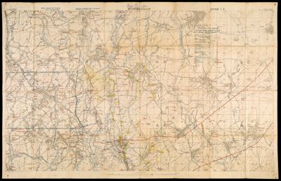
Montbrehain
Collection: Story Collection
Name: Montbrehain
Barcode: 15085
Notes: "Information from captured German maps printed in red (except detail names)." Montbrehain is situated in the northwestern sector of the Department of the Aisne (France). During World War I the village was taken by the British from the Germans on October 3, 1918. The British could not hold their position. The village was finally captured by an Australian infantry battalion two days later.WWI map.
Date/Date Range Produced: 1918
Language: English
Region Depicted: France
Dimensions: 52 x 87 cm
LC Call Number:
OCLC: 645240934
Donor: Story
Subjects: World War, 1914-1918
Permenant URL: https://oshermaps.org/map/15085.0001