General Highway Map Hancock County, Maine prepared by the State Highway Commission Planning & Survey Division, in cooperation with the Public Roads Administration Federal Works Agency
Collection: Osher Collection
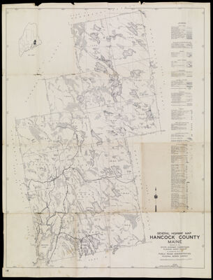
Name: General Highway Map Hancock County, Maine prepared by the State Highway Commission Planning & Survey Division, in cooperation with the Public Roads Administration Federal Works Agency
Barcode: 1547
Creator: Maine. State Highway Commission
From Atlas: No
Notes: Note at bottom right indicates highways and other transportation facilities were revised in 1945. Map has date of 1938.
Publisher: Maine. State Highway Commission
Date/Date Range Produced: 1945
Date/Date Range Published: 1945
Language: English
Region Depicted: Hancock County, Maine
Map Type: GeographicalPolitical mapsRoad maps
Dimensions: H 61.3 x W 46.6 cm
Material Type: Paper
LC Call Number: G3733.H3 P2 1945
OCLC: 70868063
Donor: Osher
Subjects: Hancock County (Me.)MaineMaine--MapsMaine. State Highway CommissionRoad maps
Permenant URL: https://oshermaps.org/map/1547.0001