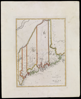
The District of Maine
Collection: Osher Collection
Name: The District of Maine
Barcode: 12105
Creator: Carey, Mathew, 1760-1839Warnicke, John G., -1818
Publishing Location: Philadelphia
Notes: Map with outline hand coloring of state and county boundaries including the five original counties of York, Cumberland, Kennebec, Hancock, and Washington. Hand colored outlines indicate the county boundaries.Note below title: "Engrd. by John G. Warnicke."
Date/Date Range Produced: 1814
Date/Date Range Published: 1814
Language: English
Region Depicted: Maine
Dimensions: 41 cm. x 58 cm. on sheet 45 cm. x 62.cm.
Printing Process: Engraving
Printing Technique: Copper
Material Type: Paper
LC Call Number:
OCLC: 694918967
Donor: Osher
Permenant URL: https://oshermaps.org/map/12105.0001