Collection: Osher Map Library Collection
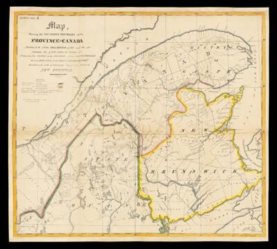
Name: Map shewing the southern boundary of the province of Canada according to the royal proclamation of 1763 and the Imperial Act of 1774 called the Quebec Act distinguishing that portion of the boundary settled conventionally with the United States by the Treaty of Washington in 1842, and exhibiting the line of boundary claimed by the province of New Brunswick.
Barcode:
Creator:
Publishing Location:
Language:
Dimensions: 61 x 68
LC Call Number: G3400.F2 1845 M3
OCLC: 948202462
Accession Number: OML-1845-40
Permenant URL: