Collection: Osher Map Library Collection
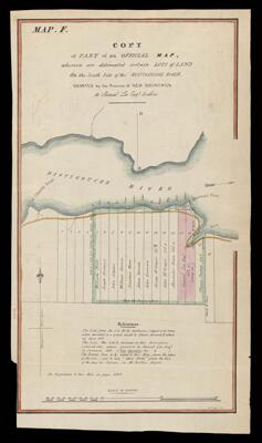
Name: Copy of part of an official map whereon are delineated certain lots of land on the south side of the Ristigouche River granted by the Province of New Brunswick to Samuel Lee & others.
Barcode:
Creator:
Publishing Location:
Date/Date Range Produced:
Date/Date Range Published:
Language:
Dimensions: 34 x 19
LC Call Number: G3432.R4 C6 1845
OCLC: 948203096
Accession Number: OML-1845-43
Permenant URL: