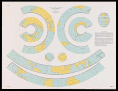
Outline maps for the construction of a model of the world, based on the Lambert conformal conic projection
Collection: Osher Map Library Collection
Name: Outline maps for the construction of a model of the world, based on the Lambert conformal conic projection
Barcode: 53620
Notes: Designed to be cut and assembled as a globe"No. 3093."Includes "Directions for assembly of the Lambert conformal conic model of the world" with col. ill
Publisher: U.S. Coast and Geodetic Survey
Date/Date Range Produced: 1944
Date/Date Range Published: 1944
Language: English
Region Depicted: World
Dimensions:
LC Call Number: G3201.B72 1944 .U5
OCLC: 5491767
Permenant URL: https://oshermaps.org/map/53620.0001