Collection: Osher Map Library Collection
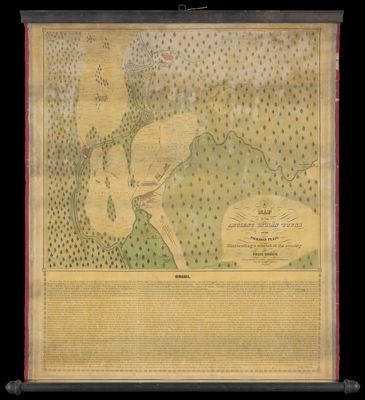
Name: A Map of the ancient Indian towns on the Pickaway Plain illustrating a sketch of the country by Felix Renick
Barcode:
Creator:
From Atlas:
Publishing Location:
Surveyor:
Date/Date Range Produced:
Language:
Region Depicted:
Map Type:
Dimensions: 46 x 51 cm on sheet 68 x 57 cm
LC Call Number: G4083 1846.P5
OCLC: 858556728
Subjects:
Permenant URL: