Collection: Textile Museum Collection
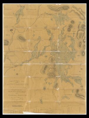
Name: Topographical map of the Lake Company's Reservoirs compiled from the N.H. state map and original surveys made under the supervision of James Bell by J.H. Wilds, civil engineer
Barcode:
Creator:
Publishing Location:
Notes:
Date/Date Range Produced: 1852 - 1866
Language:
Map Type:
Dimensions: 93 x 70 cm
LC Call Number: G3742.C31 1852 W5
OCLC: 1035846963
Accession Number: ATH-1852-52
Donor:
Permenant URL: